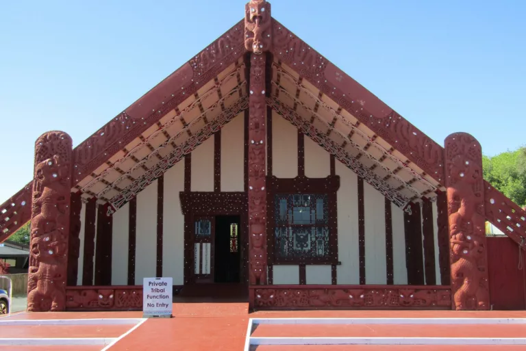
Nau mai, Haere Mai
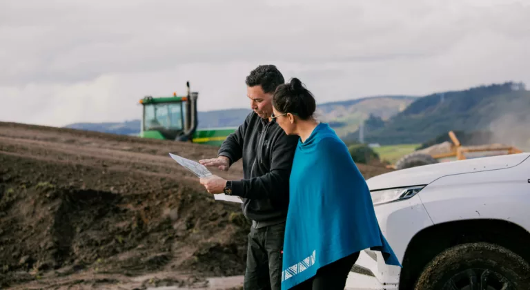
Since its formation on the 26th of July 1960, the Incorporation has been in the farming industry and includes three sheep and cattle stations.
For more information about our farms click here.
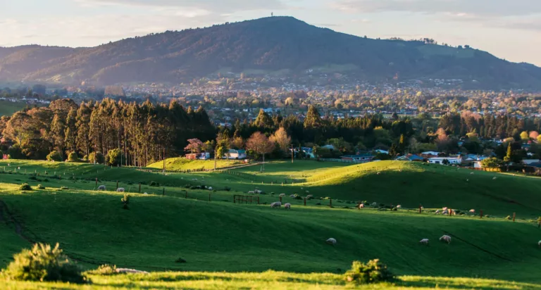
The Incorporation owns 3,000 hectares of land surrounding the Rotorua township of which 1,800 hectares is part of 3 sheep and beef stations, 600 hectares are in forestry, small parcels of land are under lease and the balance is in native trees or riparian planting.
We receive lease income from telecommunication sites, rental properties, a drug and alcohol rehabilitation facility and other small tourism operations across the whenua.
These activities contribute to providing benefits to our shareholders and Iwi through initiatives such as the Grants, Whenua Planting Project and Housing Strategy which is aiming to support those who need rental accommodation, those who are in a position to purchase a property, and also our kaumātua who may be amenable to papakainga options.
Our Mission
To safeguard and improve corpus lands, grow our assets, build capacity and increase the wellbeing of Ngāti Whakaue.
Our Vision
To be a significant contributor to the wellbeing and advancement of Ngāti Whakaue lands and people.
Our Team
Our team are committed to upholding the honour of both the land and the people.
Learn more and meet our team.
Purpose of Ngāti Whakaue Tribal Lands
The Purpose of Ngāti Whakaue Tribal Lands Incorporation is to:
- Safeguard and improve corpus lands
- Grow our asset base
- Contribute to increasing the wellbeing of Ngāti Whakaue
- Achieve owner expectations
- Provide opportunities for our future generations
Our Whakatauki
The Incorporation’s Whakatauki is Mana Whenua, Mana Tāngata.
We are committed to upholding the honour of both the land and the people.
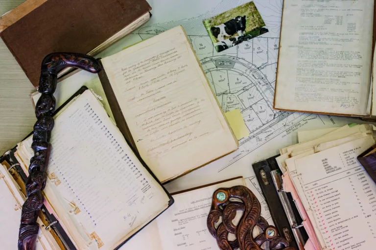
Incorporation History
The Incorporation was formed on the 26th day of July 1960 through the amalgamation of 34 Māori land blocks held by Ngāti Whakaue descendants. It was formed to farm the lands. All rights relating to that activity were passed to the Committee of Management – the elected officials who run the Incorporation.
The Judgement says:
The matter has been traversed at much length over the last 3 years and the Court is satisfied that whatever they may one day say, the people now desire incorporation. Mr Tait’s statement probably puts the matter in the right perspective namely that Ngāti Whakaue are coming in as partners not as benefactors”
Another comment in appointing the committee of management highlighted the need for self-directed development saying, “This is one of the most substantial undertakings in the Bay of Plenty. Experience and ability are essential prerequisites to success” a decision on the appointment of the Committee was therefore delayed until a meeting at Tamatekapua Marae could be held.
Raniera Kingi made the closing comment at Court “We feel that neither we nor the Court can override the Act “the owners may appoint a committee”. Businessmen know nothing about farming – I have 25 years as a farming administrator. A good businessman is useless”.
First Committee of Management
The First Committee of Management was formed on 20th February 1961 with the inaugural members being:
- Frederick Bubb of Tokerau, Farmer
- Piwiki Heke of Rotorua, Draughtsman
- Alister Murray Linton of Rotorua, Civil Servant (he was then the Mayor of Rotorua)
- Willie Rika of Tirau, Farm Manager
- Tahi Tait of Koutu, Rotorua, Civil Servant
- Huia Tapsell of Koutu, Rotorua, Civil Servant
- Hohepa Mei Tatere of Dannevirke, Farmer
More information will be added to this historical account periodically.
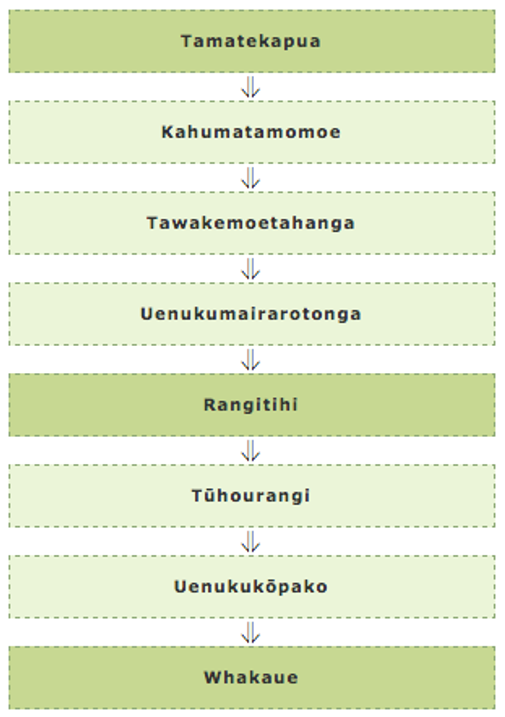
Ngati Whakaue Whakapapa
Whakaue Kaipapa, the eponymous ancestor of Ngati Whakaue is descended eight generations from Tamatekapua. His genealogy shown in the chart.
Whakaue was, through Uenukukopako, a great grandson of Rangitihi. His grandfather Tuhourangi together with Tuhourangi’s older siblings were known as “nga pumanawa e waru o Rangitihi”.
Ngati Whakaue reside at Maketu, the landing place of Te Arawa waka, and Rotorua.
Our Six Koromatua
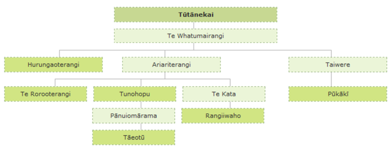
It is during the times of Tutanekai that the name Ngati Whakaue became both prominent and recognised as the umbrella title covering the independent entity of Whakaue’s, and more particularly Tutanekai’s descendants who inhabit the shores of Rotorua.
The genealogy of Tutanekai and his descendants is outlined as follows showing the major ancestors after whom, in particular, the now well known “Koromatua hapu” of Ngati Whakaue are named.
Ngāti Whakaue History
Proud son of a proud nation
Tamarahi Pāriri
Pillar that upholds the heavens
Tītoko o te rangi
You that allows the sun to shine
Whakawhiti o te rā
You that causes peace to reign on earth
Whakaaio whenua e
These are phrases used to describe chiefs such as Whakaue Kaipapa, a descendant of the noble lines of chiefs who brought the canoe Te Arawa from the homeland of their forebears, of Houmaitawhiti and others, who encouraged his relations to “find a place where they may die a peaceful death”.
Tamatekapua and his compatriots heeded the words of Houmaitawhiti when they left far distant Hawaiki, and although they descended for a time into the throat of the Parata, and were subjected to the anger of Ngatoroirangi, Te Arawa landed safely at Maketu. The children of Tamatekapua were sent to scout the land and seek an appropriate place for them to live, and so Kahumatamomoe and Ihenga arrived in the interior of the stomach of the great fish of Maui. They named the mountains, the rivers, and the lakes from Maketu to Tongariro.
By the time of Whakaue, his father Uenukukopako had taken control of Te Motutapu a Tinirau (Mokoia). He wanted to erect a pa (fortified village) on Mokoia, and also others around the shores of Lake Rotorua nui a Kahumatamomoe. When his son Tutanekai arrived, he had already built a pa at Weriweri. It was Tutanekai who raised his people to become the tribal force known as Ngati Whakaue.
Before the sacking of Mokoia, Ngati Whakaue had gained control over Pukeroa and Ohinemutu, and still held those areas when these issues were contested by different tribal groups before the land court of the day.
The beginnings of Whakaue Kaipapa, like the multi dimensions of his offspring, are not bound to the mere physicality of the natural world, nor are they limited to Aotearoa.
They extend across the expanses of Te Moana nui a Kiwa within and without the spiritual and metaphysical domains of Tangaroa and Hinemoana; Ranginui and Papatuanuku.
The patere that follows explores the dynamics of existence and identity which have evolved from the time of Houmaitawhiti, the forebear of Whakaue and resident of distant Hawaiki. This dynamism lingers in the present day generations with a pointer to futures untold signified in the concluding melody. The patere records the patterns and lessons that have been outlined and embedded within the psyche of the many generations that have followed Houmaitawhiti. These patterns are evident and prevalent in the descendants of Whakaue, in the Whakaue of today and the Whakaue of the future.
The waiata commences with a reminder that out of a concern to avoid overcrowding in Rangiatea a monumentous decision to settle elsewhere in the Pacific was made. This concern, coupled with the cumulative knowledge of the abundance of far off places gleaned from the voyages of Kupe and others, catapulted Tamatekapua to fashion an expedition which was to shape the destiny of those who would follow irrevocably.
The fashioning of the canoe Te Arawa with its eventual launch accompanied by both tohunga and kaihautu Ngatoroirangi, and Tamatekapua respectively, led to the migration of the peoples of the Arawa canoe to the shores of Aotearoa. Those who accompanied these great leaders on the canoe Te Arawa also played a leading role in the settlement of the coastal areas and hinterland of Te Ika a Maui (The North Island).
The journey was eventful. However it was the enduring love of Ngatoroirangi for Kearoa his wife, that withstood the storm of her liaison with Tamatekapua, and which ultimately secured the safe arrival of the Te Arawa canoe and its occupants to Aotearoa, notwithstanding the summonsing of the wrath of the gods brought about by the powers of Ngatoroirangi in seeking retribution against Tamatekapua’s deceptions by despatching the Te Arawa canoe to Te Korokoro o te Parata.
The fact that Tamatekapua commanded the canoe Te Arawa from Hawaiki to Aotearoa landing at and occupying Maketu34 reverberates throughout the many realms that the peoples of Te Arawa have touched. His temerity and ingenuity and that of his younger brother Whakaturia knew no boundaries as the history of Te Arawa recalls. Their roles in acquiring the breadfruit of Uenuku, in the use of stilts by Tamatekapua to rescue his younger from Uenuku’s revenge, in engaging his elder Tia to build the canoe to be called Te Arawa, in pre-empting Ngatoroirangi’s original intention to voyage on the canoe Tainui so that he would have the most powerful of High Priests as part of his contingent on the canoe Te Arawa, in engaging in an inappropriate affair with the wife of the High Priest, in ensuring Whakaotirangi came on the canoe Te Arawa, in voyaging to other parts of Te Ika a Maui on the canoe Te Arawa thereby naming places visited by him and finally by his descendants occupying all of the land from Maketu through to Taupo all examples of the audacity of one unbounded by convention.
One only has to look at the stories about Tamatekapua to realise that many of the attributes he had are still prevalent among Te Arawa (men) today. There is the cheek and ingenuity of using stilts to steal the breadfruit of the Tohunga Uenuku and the lover of the Tohunga Ngatoroirangi; there is the passion and valour of rushing to Whakaturia’s rescue and engineering Ngati Ohomairangi’s subsequent migration to Aotearoa; there is the mischief and amorous nature of the numerous illicit affairs he had and the rippling effects of those affairs that he left in his wake.
With Ngatoroirangi and Tia secure within the realms of the waka you have the more serious tohunga aspects cemented within the evolving peoples of Arawa, conducting protocols properly; appropriate behaviour – somewhat similar to a tuakana role as opposed to that of a teina.
By Whakaue’s time he occupied lands at Rotorua and had established his mana as others of the descendants of the children of his ancestor Rangitihi three generations above him had done.
Whakaue was, through Uenukukopako, a great grandson of Rangitihi. His grandfather Tuhourangi together with Tuhourangi’s older siblings were known as “nga pumanawa e waru o Rangitihi”. The genealogy showing the “eight beating hearts” of Rangitihi.